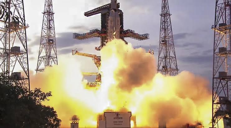
GSLV-F16 launches the NISAR satellite, a milestone in Indo-US space collaboration, aiming to provide Earth observation data globally.
India and US Unite in Space for Earth Observation
In a historic event, ISRO and NASA jointly launched the NISAR satellite on July 30, 2025. The satellite lifted off aboard the GSLV-F16 rocket from the Satish Dhawan Space Centre in Sriharikota, Andhra Pradesh.
This marks the first joint Earth observation mission by the Indian Space Research Organisation (ISRO) and the National Aeronautics and Space Administration (NASA).
What Is the NISAR Satellite?
NISAR stands for NASA-ISRO Synthetic Aperture Radar. It is a sophisticated Earth observation satellite equipped with advanced radar imaging technology. The satellite will orbit Earth at a distance of 743 km in a sun-synchronous orbit.
It will scan the entire globe every 12 days, delivering all-weather, day-and-night imagery. With its dual-frequency L-band and S-band radars, NISAR will capture minute changes on Earth’s surface.
 Key Applications of NISAR
NISAR will serve critical global needs across a range of sectors:
- Disaster Management: Detects earthquakes, landslides, and floods in real-time.
- Agriculture: Monitors crop patterns and soil moisture.
- Climate Science: Tracks glacier movement, ice sheet deformation, and rising sea levels.
- Urban Planning: Identifies land subsidence and infrastructure vulnerabilities.
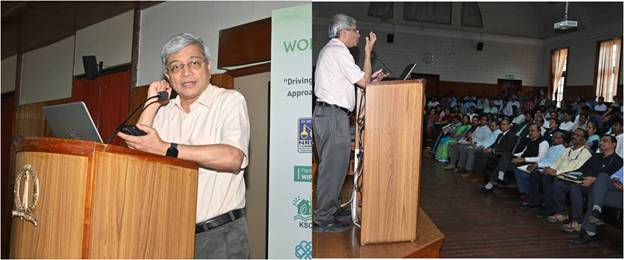
According to ISRO’s Space Applications Centre director Nilesh Desai, “NISAR is a classic example of collaborative effort between two great democratic countries.”
A New Era of Scientific Collaboration
The satellite weighs 2,392 kg and is one of the most expensive Earth observation missions ever undertaken by India. Scientists from both agencies have worked together for years to develop NISAR’s radar systems and onboard technologies.
Former ISRO scientist Radha Krishna Kavuluru emphasized that this mission demonstrates India’s growing expertise in space engineering. “This is a science mission that excites researchers worldwide,” he said.
Global Access to NISAR Data
One of NISAR’s key contributions is its open-access data policy. The information it collects will be freely available to researchers, governments, and organizations across the world.
This will especially benefit developing nations lacking Earth observation infrastructure.
India’s Scientific Handshake with the World
Science and Technology Minister Dr. Jitendra Singh called NISAR “India’s scientific handshake with the world.” He noted that the mission aligns with Prime Minister Modi’s vision of India as a “Vishwa Bandhu” — a global partner working for the betterment of all humanity.
“NISAR will serve not just India and the US, but all nations relying on timely Earth observation data,” Dr. Singh added.
Why NISAR Matters More Than Ever
With climate change and natural disasters becoming more frequent, the world needs accurate, timely data to prepare and respond effectively. NISAR fills that critical need.
Space scientist R.C. Kapoor summed it up: “NISAR will generate enormous volumes of high-resolution data daily. It is the most advanced Earth observation satellite to date.”
A Milestone in Indo-US Space Ties
This mission strengthens ISRO-NASA relations and sets a precedent for future collaborations. It also puts India firmly on the map as a key player in the global space race.
The successful launch showcases India’s capacity to deliver complex missions and deepen its role in global scientific progress.
Conclusion
The NISAR launch is not just a technical achievement. It’s a moment of pride, partnership, and purpose. It underlines India’s rising stature in space technology and reinforces the power of global cooperation.
From monitoring the Earth to managing disasters, NISAR’s eyes will help protect lives, support agriculture, and aid in fighting climate change — making this mission a true leap for mankind.