 Odisha Not Under Direct Threat, Says IMD
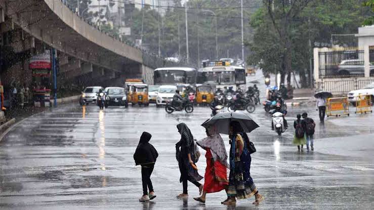
According to the IMD’s regional office in Bhubaneswar, the system is unlikely to have a direct impact on Odisha. However, several coastal and southern districts could witness light to moderate rain and thunderstorms over the next 24 hours. Areas including Ganjam, Gajapati, Khurda, Puri, Nayagarh, and Cuttack are likely to experience short spells of rain accompanied by gusty winds.
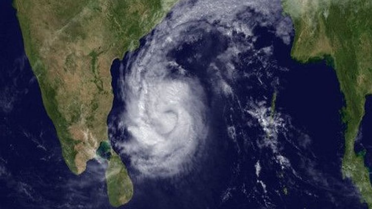
IMD Bhubaneswar Director, Dr. Manorama Mohanty, stated that the upper air cyclonic circulation persists up to 1.5 km above mean sea level and is showing signs of intensification. “A low-pressure area is likely to form by October 21 and further strengthen into a Depression over the central Bay of Bengal during the next 48 hours,” she said.
Fishermen Advised to Stay Alert
The IMD advisory has urged fishermen to avoid venturing into the deep sea until further updates. Coastal residents have been advised to monitor official weather bulletins closely as the system evolves.
Wind speeds between 30–40 km/h are expected in coastal districts like Balasore, Bhadrak, Jagatsinghpur, and Kendrapara on Monday. Authorities have asked local administrations to stay prepared for any localized flooding or disruption due to lightning and heavy showers.
Rainfall Recorded Across Odisha
During the past 24 hours, light to moderate rainfall occurred in several parts of Odisha, with the highest amount recorded in Ganjam district (61.28 mm). The IMD also noted thunderstorm activity in Rayagada, Malkangiri, and Koraput districts, which may continue intermittently.
The cyclonic system’s future track and intensity will be closely monitored by meteorological centers in Chennai and Bhubaneswar. If it strengthens further, the IMD may issue a formal name once it reaches the tropical storm stage, as per World Meteorological Organization guidelines.
Outlook for the Coming Days
While Odisha is expected to remain largely safe from severe impact, residents may experience occasional showers and overcast skies. The weather office expects clearer conditions toward the end of the week as the system moves westward over the central Bay.
Officials have reiterated that continuous updates will be shared as the system evolves, ensuring timely preparedness for any eventualities.