
The India Meteorological Department (IMD) has forecast that Cyclone Montha, currently a deep depression over the southeast Bay of Bengal, is likely to intensify into a “severe cyclonic storm” and make landfall on the coast of Andhra Pradesh near Kakinada between Machilipatnam and Kalingapatnam on the evening or night of 28 October.


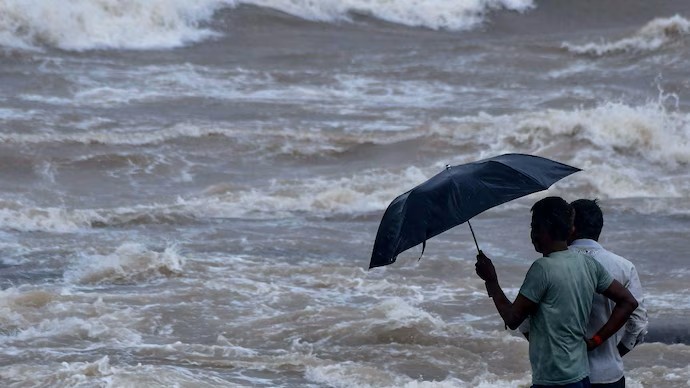
The IMD has issued heavy to very heavy rainfall alerts for several states across the east coast. In Andhra Pradesh and the union territory of Yanam, rainfall is expected between 26-30 October. For Odisha, alerts cover 27-30 October, with a red warning (take action) issued for districts such as Malkangiri, Koraput, Rayagada, Gajapati and Ganjam. In neighbouring West Bengal, rain is expected in south districts from 28-31 October, and fishermen are advised to stay ashore from 28-30 October.
Beyond the east coast, parts of Tamil Nadu, Kerala and coastal Karnataka are also under yellow/orange alerts for heavy rainfall during 26-28 October.
Preparations underway
The Odisha government has placed all 30 districts on alert. Disaster response teams including the Odisha Disaster Rapid Action Force (ODRAF), the National Disaster Response Force (NDRF) and multiple fire-service units have been deployed in vulnerable districts. Landslide-prone areas have been identified and people from hilly terrain evacuated.
In Andhra Pradesh, authorities have stocked up essential supplies including fuel, LPG, power backup for telecom towers, and Public Distribution System (PDS) commodities. District collectors have been tasked with coordinating with oil marketing companies and ensuring supply continuity. Fishermen are explicitly advised to avoid venture into the sea from 26 October onwards.
What to watch for
Key hazards include extremely heavy rainfall (≥ 200 mm in isolated places), high wind speeds, storm surge of around 1 m above astronomical tide, and flooding of low-lying areas along the coast Residents in vulnerable districts are advised to remain alert, follow official evacuation orders, and secure loose objects outdoors ahead of the storm’s arrival.
The IMD also cautions that even inland districts such as those in Telangana and Chhattisgarh may receive heavy rainfall between 27-30 October due to the system’s out-flow.