
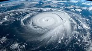

The IMD says the low-pressure formed under the influence of an upper-air cyclonic circulation and is moving west-northwestwards. Forecast models indicate the system could become a depression within 24–48 hours and a cyclonic storm by around November 26, though exact intensification timing may vary with sea-surface and atmospheric conditions.
Meteorologists caution that the track remains uncertain at this stage: while some model runs show a west-northwest movement towards the Tamil Nadu–Andhra coastline, others suggest a more northerly curve that could steer the system toward Odisha or Bangladesh. Officials will refine track and landfall forecasts as the system strengthens.
IMD warnings: who will be affected
The IMD has issued heavy to very heavy rainfall warnings (105–204 mm in 24 hours) for the Nicobar group on November 24–25, and widespread heavy rain forecasts for the Andaman & Nicobar Islands through November 28. Tamil Nadu, Kerala and Mahe face heavy rainfall (with very heavy spells possible on Nov 23–24), while coastal Andhra Pradesh, Yanam and Rayalaseema may get heavy showers in the short term. Wind speeds in affected island areas are expected to be 35–45 km/hr, gusting to 55–65 km/hr as the system approaches.
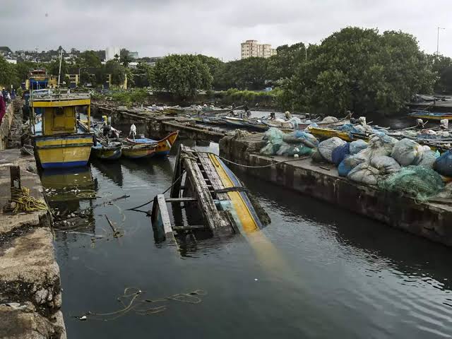
Local impacts: schools, fisheries and coastal precautions
Several districts in Tamil Nadu announced school closures amid persistent rains and localized flooding. State administrations have urged coastal communities, fishing vessels and tourists to avoid venturing into the sea until the situation stabilises. Fishermen in the Andaman and Nicobar Islands have been specifically advised not to fish and to secure boats and gear.
Authorities typically issue graded alerts from ‘be aware’ to ‘action’ depending on intensity and proximity. Residents in low-lying coastal areas should keep emergency kits ready, follow local administration advisories and heed evacuation instructions if issued.
Why the Bay of Bengal still produces strong post-monsoon cyclones
The Bay of Bengal often spawns powerful systems in the post-monsoon window (October–December) when sea surface temperatures remain warm and vertical wind shear can be favourable. Meteorologists note that quick monitoring and early public advisories help reduce casualties, but agricultural losses and coastal flooding can still be substantial. The recent Cyclone Montha earlier this season is a reminder of the region’s vulnerability.
What to watch for next
IMD will issue regular updates with track maps and warnings; the next 48 hours are critical for narrowing down probable landfall timing and location. For official updates, readers should follow the IMD portal and state disaster management authorities.