New Delhi, June 1, 2025 —
The Government of India is all set to launch the second phase of training under its landmark NAKSHA (National Geospatial Knowledge-Based Land Survey of Urban Habitations) programme from June 2, 2025. The training aims to build the skills of urban officials in using advanced geospatial technology for modern land surveys in Indian cities.
Organised by the Department of Land Resources (DoLR) under the Ministry of Rural Development, the capacity-building programme will be conducted across five Centres of Excellence (CoEs) across the country.
Launch and Training Schedule
The second phase will be inaugurated virtually on June 2 at 10:00 AM by Shri Manoj Joshi, Secretary, Department of Land Resources. The week-long training will run from June 2 to June 8, 2025.
In this round, 304 officers from 157 Urban Local Bodies (ULBs) have been nominated to take part. These include ULB-level and district officers who are directly responsible for urban land management and property surveys.
The training will be held at the following Centres of Excellence:
- Lal Bahadur Shastri National Academy of Administration (LBSNAA), Mussoorie, Uttarakhand
- Yashwantrao Chavan Academy of Development Administration (YASHADA), Pune, Maharashtra
- Northeast Region Centre of Excellence, Guwahati, Assam
- Mahatma Gandhi State Institute of Public Administration (MGSIPA), Chandigarh, Punjab
- Administrative Training Institute (ATI), Mysuru, Karnataka
What the Training Covers
This phase focuses on hands-on training in using modern geospatial tools and techniques. Officers will be trained in:
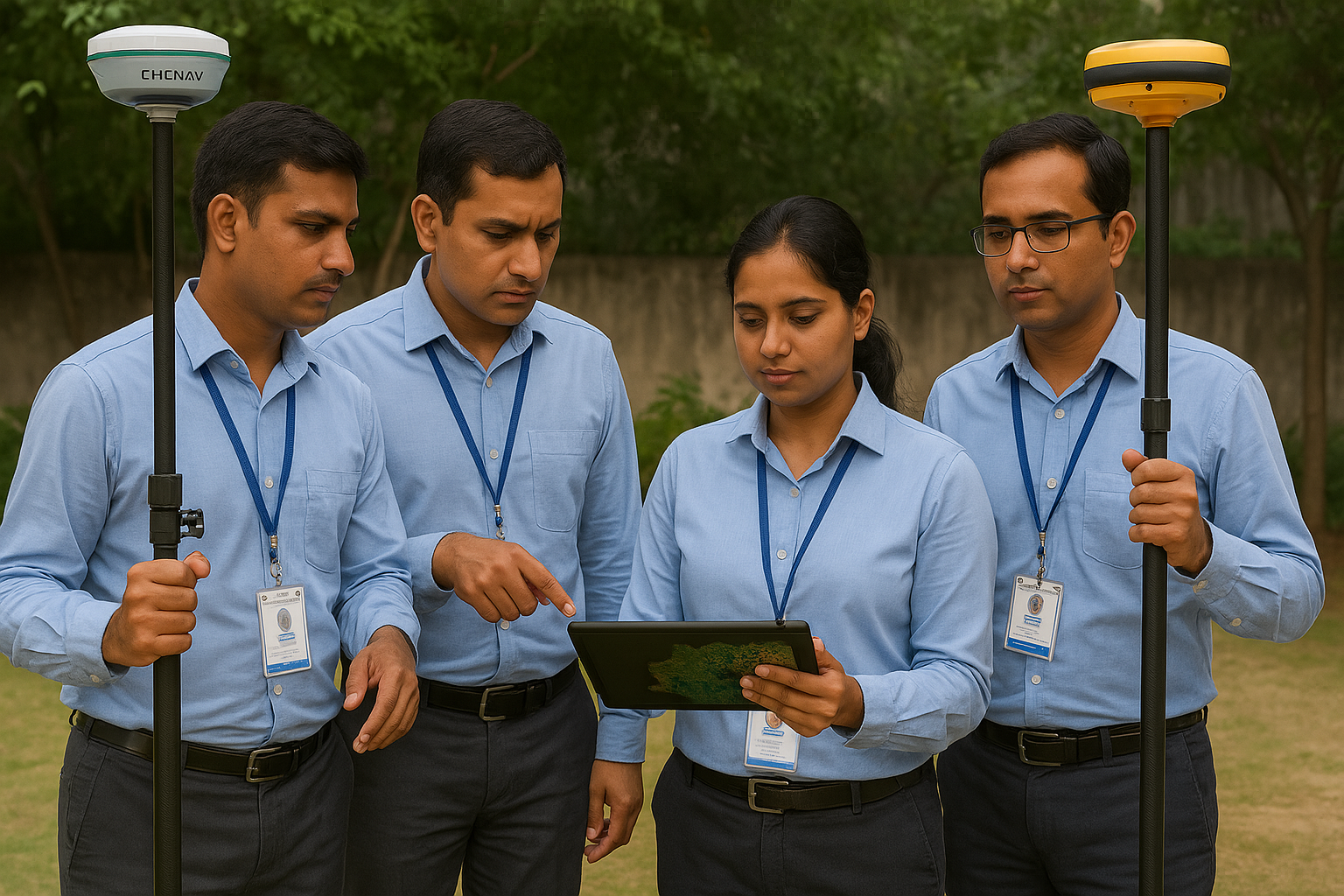
- GNSS (Global Navigation Satellite System) and ETS (Electronic Total Station)-based surveying
- Web-GIS applications for land mapping
- Legal and administrative procedures for urban land surveys
- Land parcel mapping and data integration
The goal is to equip government officials with practical skills and technical knowledge so they can supervise and support high-accuracy surveys of land and properties in urban areas.
Background: What is NAKSHA?
The NAKSHA programme is a bold initiative aimed at improving land records in Indian cities by using geospatial technology. With India’s urban population expected to exceed 600 million by 2031, the demand for clear, reliable, and accessible land ownership data is growing rapidly.
NAKSHA addresses this need through technology-driven urban land surveys, enabling better urban planning, governance, and service delivery.
The programme is being implemented by the Department of Land Resources in collaboration with:
- Survey of India
- National Informatics Centre Services Inc. (NICSI)
- Madhya Pradesh State Electronics Development Corporation (MPSeDC)
- Five National Centres of Excellence
So far, NAKSHA has been launched across 157 Urban Local Bodies (ULBs) in 27 States and 3 Union Territories as part of a pilot phase.
Successful First Phase Completed
The first phase of the NAKSHA training programme, held in May 2025, trained 160 master trainers from participating states and union territories. These master trainers are expected to play a key role in cascading knowledge and techniques to local officials and field teams.
The second phase now takes the effort further by training ULB-level officers, ensuring that knowledge reaches those directly involved in ground-level implementation.
A Step Towards Modern Urban Governance
By strengthening the skills of urban officials and using cutting-edge tools, the NAKSHA programme is a step forward in creating accurate, transparent, and digital land records. It supports better urban planning, reduces disputes, and ensures proper taxation and service delivery.