
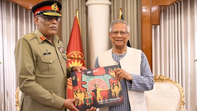
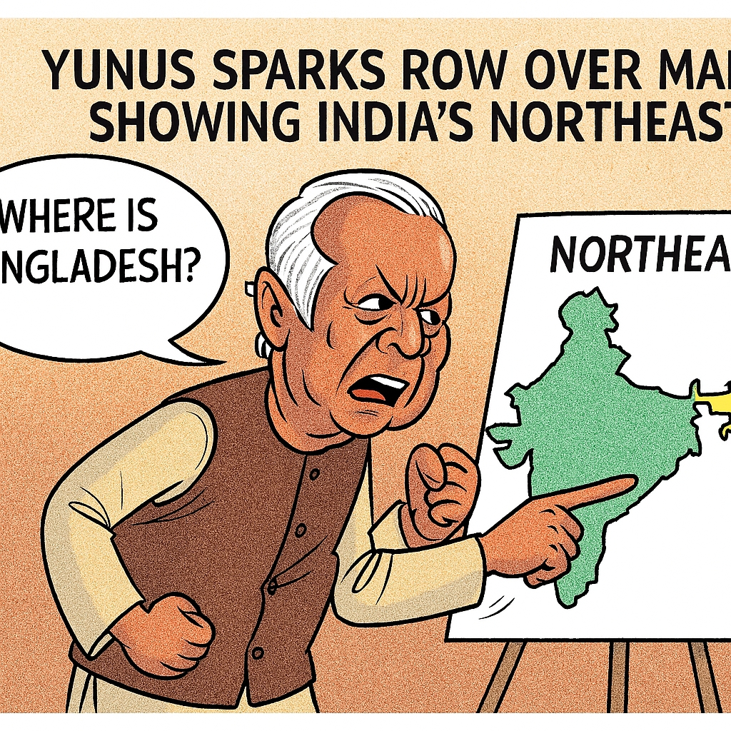

During a weekend meeting in Dhaka, Yunus presented General Sahir Shamshad Mirza with a book titled Art of Triumph. One photograph from the event shows the book’s cover bearing an altered map that depicts Assam and other northeastern states within Bangladeshi boundaries. The image circulated widely on social platforms and in Indian and international media, prompting a sharp reaction from commentators and opposition politicians in India.
Why the map is sensitive
The northeastern states — seven in number — sit at a strategic junction for India, linked to the rest of the country through the narrow Siliguri Corridor, or “Chicken’s Neck.” Any public suggestion of territorial transfer or claims over these areas touches a raw nerve in New Delhi and among northeastern leaders. The map echoes a fringe “Greater Bangladesh” narrative promoted by some radical groups in recent years, which has been repeatedly condemned by official channels in India.
Political reactions in India
Indian political leaders and analysts reacted swiftly. Voices in the northeast described the gesture as provocative. Assam and other state leaders flagged the image as unacceptable. Former and current officials used the incident to reiterate the strategic importance of the Siliguri Corridor and to warn against attempts to politicise maps and borders for domestic or regional symbolism.
So far, India’s Ministry of External Affairs has not issued an official statement on the specific incident; however, diplomatic sources say New Delhi is monitoring the situation closely and taking note of public sentiment and media coverage.
Context: a recurring flashpoint
This is not the first time the topic has surfaced. Similar maps and statements have occasionally appeared in Dhaka’s public discourse since 2024, sometimes promoted by fringe groups or individuals. In April 2025, an exhibition at the University of Dhaka featured a disputed map that drew attention across the border. Critics say the repeated references risk stoking mistrust between neighbours and complicate an already delicate diplomatic landscape.
Diplomatic implications
The gift comes at a moment of shifting alignments in South Asia. Bangladesh’s current leadership has pursued closer ties with Pakistan and China, moves that have prompted concern in New Delhi about strategic balance in the region. Experts say symbolic acts — even if not official policy — can influence perceptions and are often amplified by social media and partisan commentary.
What to watch next
Watch for an official response from India’s Ministry of External Affairs and any clarification from Dhaka about whether the image was an editorial/artistic choice or an authorised government symbol. Regional leaders may also respond formally if public pressure mounts. Analysts urge measured diplomatic engagement to prevent escalation and recommend the use of official channels to resolve misunderstandings.